
Drone Mapping & Geospatial Data Processing
From Aerial Data to Reliable Geospatial Information
NG Net PLLC provides professional drone mapping, photogrammetry, LiDAR processing, and geospatial analysis for surveying, engineering, land development, infrastructure, and environmental projects.
Our services cover the complete UAS mapping workflow—from mission planning and survey control to aerial data collection, processing, quality control, analysis, and final deliverables.
We also provide independent processing of client-provided drone imagery, LiDAR, and point-cloud data. Whether you need complete aerial mapping or assistance transforming existing datasets into usable geospatial information, we can develop a workflow tailored to your project.
Our Drone Mapping Services
- Aerial Photogrammetry: High-resolution imagery processing, georeferenced orthomosaics, and three-dimensional point-cloud generation.
- UAS LiDAR Mapping: Terrain and infrastructure mapping using project-appropriate LiDAR technology.
- Topographic Mapping: Surface modeling, elevation analysis, contours, and terrain documentation.
- Survey Control Integration: GNSS control, ground control points, check points, and coordinate-system verification.
- Point-Cloud Processing: Georeferencing, classification, filtering, surface generation, and feature extraction.
- Client-Provided Data Processing: Processing and QA/QC of existing UAS imagery, LiDAR, and geospatial datasets.
- CAD & GIS Integration: Preparation of geospatial information for Civil 3D, MicroStation, GIS, and other project workflows.
Project Deliverables
Depending on project requirements, deliverables may include:
- Georeferenced orthomosaic maps
- Colorized point clouds
- LAS, LAZ, E57, and RCP-compatible datasets
- Digital surface and terrain models
- Contours and elevation maps
- CAD drawings and GIS-compatible data
- Geospatial analysis and QA/QC reports
Why Choose NG Net PLLC?
Our approach combines professional land surveying knowledge with modern UAS mapping, GNSS control, LiDAR, photogrammetry, and geospatial processing.
We focus on producing technically consistent, documented, and usable data—not simply aerial photographs.
Already Have Drone Data?
Send us your existing imagery, LiDAR, or point-cloud files. We can evaluate the available data and provide processing, analysis, and project-specific deliverables.
Contact NG Net PLLC to discuss your aerial mapping or geospatial data processing project.
Share:
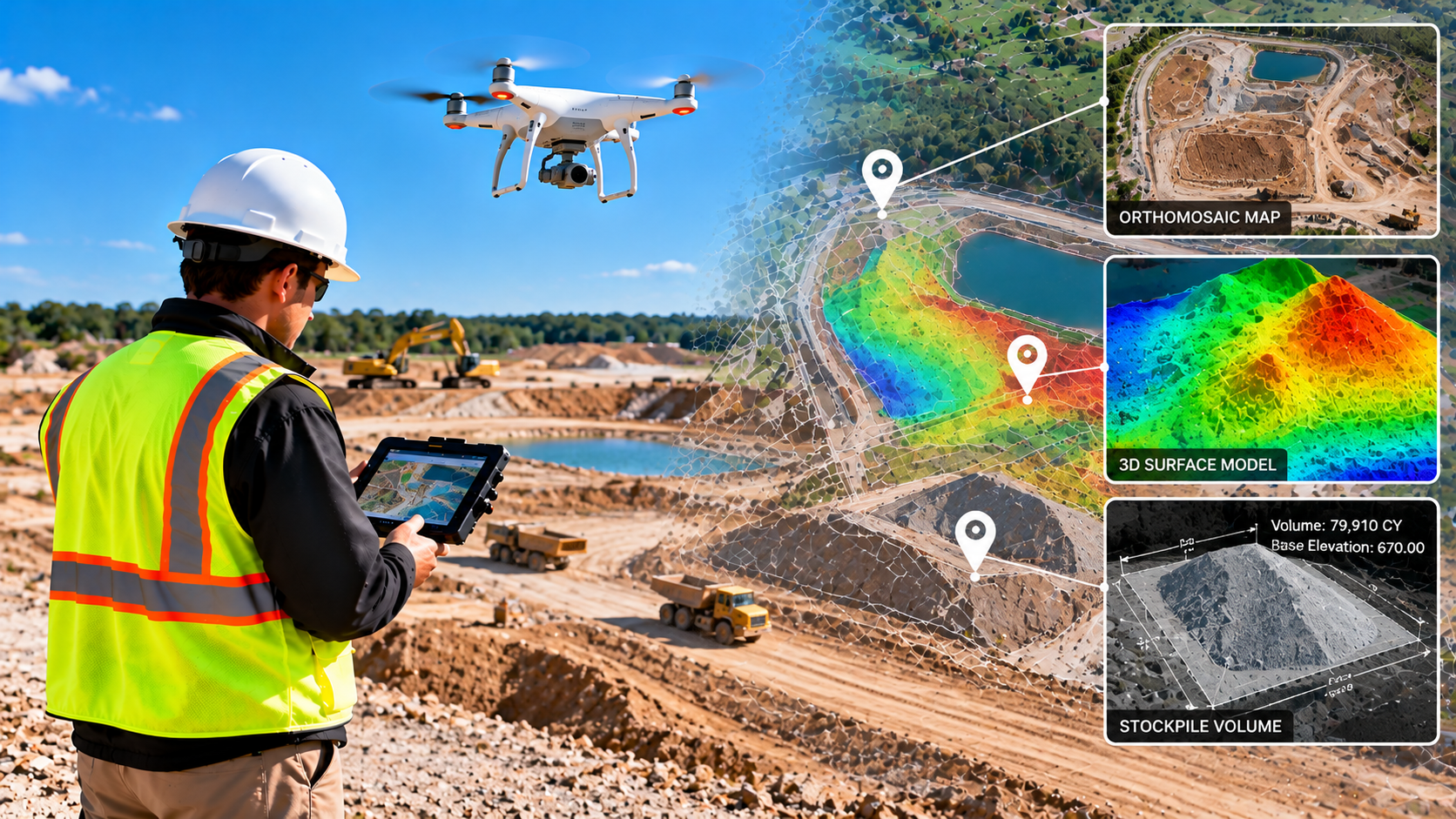
Construction Drone Mapping & Earthwork Analysis
October 8, 2026
Support construction planning and progress monitoring with drone-based mapping and earthwork analysis. NG NET PLLC provides aerial site documentation, orthomosaics, surface models, stockpile volume calculations, and terrain comparisons to help contractors and engineers evaluate site conditions, track progress, and document changes over time.
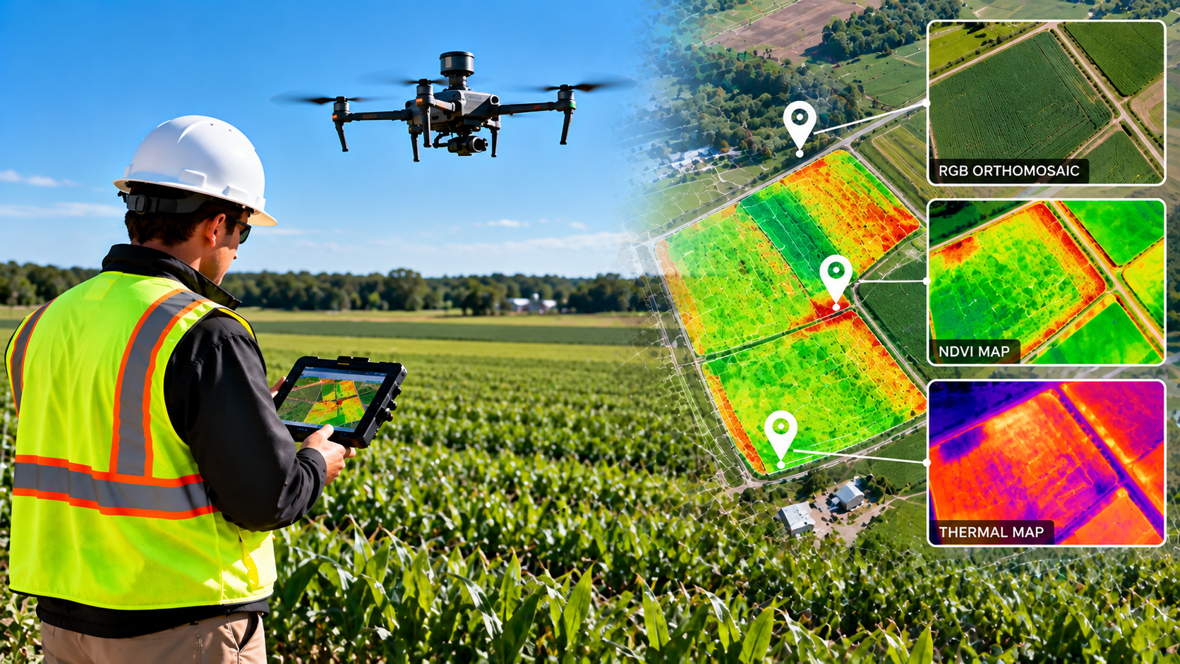
Agricultural Drone Mapping & Crop Monitoring
October 8, 2026
NG NET PLLC provides agricultural drone mapping and geospatial data processing to support crop monitoring and land management. Using multispectral imagery, vegetation indices such as NDVI, and thermal data when appropriate, we help clients identify vegetation patterns, assess field variability, and visualize changing agricultural conditions.
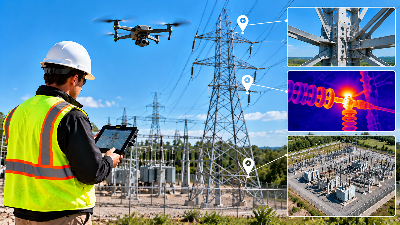
Drone Inspections & Infrastructure Documentation
October 8, 2026
NG NET PLLC provides drone-based visual inspections and aerial documentation for buildings, infrastructure, utilities, and industrial facilities. High-resolution imagery and geospatial data help clients document existing conditions, identify areas requiring further investigation, and support maintenance planning while reducing the need for direct access to difficult-to-reach locations.